Case Background: In September 2018, we were commissioned by a South African mine to conduct advanced geological forecasting at the shaft opening (6m in footage) to provide a reference for advanced water exploration and grouting before subsequent excavation.
Exploration interpretation: There is a relatively low-resistance area 40 to 70 meters from the bottom of the shaft due north. It is geologically inferred that this section passes through an aquifer or a water-rich fracture zone. There is also a weak, low-resistance area 40 to 60 meters from the bottom of the shaft due south. It is geologically inferred that this section passes through a fracture zone.
Exploration suggestion: It is recommended to conduct advanced water exploration verification at the location due north of the well wall and determine the subsequent construction plan based on the drilling results.
Data display: Detection of three-dimensional imaging
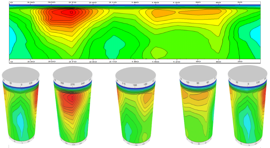
Horizontal detection diagram and 3D histogram at 15 degrees vertically downward
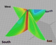
Bottom exploration 3D results figure