
Import all survey line dat files, support recognition of plane coordinates, and layout of construction work areas with irregular survey lines
Draw floor plans or fan diagrams in batches with one click
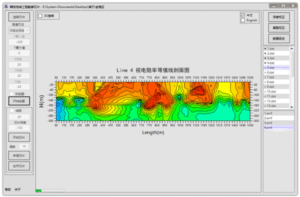
Figure 1. The apparent resistivity contour line profile of line 4 in the on-site transient electromagnetic goaf survey.
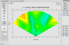
Figure 2. Transient electromagnetic bottom plate apparent resistivity contour profile of a tunnel
Draw custom depth slices of the survey area with one click
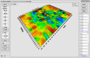
Figure 3 Transient electromagnetic survey of a work area in Hubei – 150m depth apparent resistivity contour slice
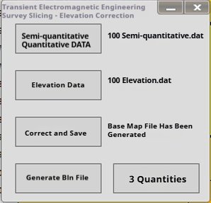
1. Depth Correction:
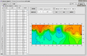
2. Elevation correction: Transient electromagnetic detection data and elevation data. The elevation data format is column A for point number and column B for elevation:
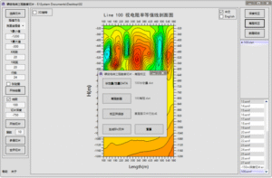
Before correction:
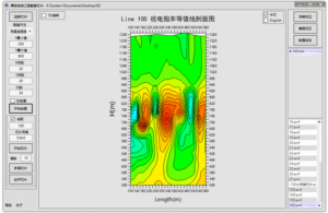
After correction:
Reviews
There are no reviews yet.